
Dhaka is the largest city in Bangladesh and one of the world’s biggest and fastest-growing megacities. As the nation’s capital, it serves as the country’s political, economic, cultural, and administrative center, attracting millions of people for work, education, and business opportunities.
However, the answer to “how big is Dhaka?” depends on what you mean by “big.” You could be referring to its land area, population, metropolitan region, population density, or even its economic influence and rapid urban expansion. While the official city covers a relatively modest area, the Greater Dhaka metropolitan region extends far beyond the city limits and is home to well over 20 million residents, making it one of the largest urban agglomerations in South Asia.
In this guide, you’ll discover Dhaka’s official size, metropolitan area, current population, population density, administrative structure, and how it compares with other major cities around the world. You’ll also learn why Dhaka continues to expand rapidly and what its future growth means for Bangladesh.
Quick Answer: How Big Is Dhaka?
| Metric | Value |
| Official City Area (DNCC + DSCC) | Approximately 306.4 km² (118.3 sq mi) |
| Greater Dhaka Metropolitan Area | Approximately 1,528 km² (590 sq mi) |
| Estimated City Population (2025) | Around 10–11 million |
| Estimated Metropolitan Population (2025) | Approximately 24–25 million |
| Population Density (City Proper) | Around 35,000–38,000 people per km² |
| Administrative Divisions | 2 City Corporations (Dhaka North & Dhaka South), 129 Wards |
Key Highlights
- Dhaka is the largest city in Bangladesh by both population and economic activity.
- The Greater Dhaka Metropolitan Area is home to approximately 24–25 million people, making it one of the world’s largest metropolitan regions.
- With more than 35,000 residents per square kilometer, Dhaka ranks among the most densely populated major cities on Earth.
- The city consists of Dhaka North City Corporation (DNCC) and Dhaka South City Corporation (DSCC), together comprising 129 administrative wards.
- Rapid urbanization and continuous migration from across Bangladesh continue to fuel Dhaka’s expansion, reinforcing its role as the country’s primary commercial, governmental, and transportation hub.
Where Is Dhaka Located?
Dhaka is located in central Bangladesh, within the Dhaka Division, and serves as the nation’s capital and largest city. Positioned on the eastern bank of the Buriganga River, the city occupies a strategic location in the heart of the Bengal Delta, one of the world’s largest river delta systems. This central position has made Dhaka an important center for trade, governance, and cultural exchange for centuries.
Geographically, Dhaka lies at approximately 23.8103° N latitude and 90.4125° E longitude, making it a key gateway between northern, southern, and eastern Bangladesh. The city’s relatively flat terrain and extensive river network have historically supported commerce and transportation, contributing to its rapid growth into a modern megacity.
As the political and economic heart of Bangladesh, Dhaka hosts the country’s major government institutions, corporate headquarters, universities, financial centers, and international organizations. Its strategic location also makes it the primary transportation hub of Bangladesh, connecting every region through an extensive network of highways, railways, inland waterways, and air routes.
Today, Dhaka is recognized as one of South Asia’s most influential urban centers, linking Bangladesh with regional and global markets while serving as the country’s principal gateway for business, tourism, and international trade.
Geographic Highlights
- Country: Bangladesh
- Division: Dhaka Division
- Region: Central Bangladesh
- River: Buriganga River
- Coordinates: 23.8103° N, 90.4125° E
- Geographical Feature: Bengal Delta
- Role: Capital city, economic center, transportation hub, and administrative headquarters of Bangladesh
What Is the Total Land Area of Dhaka?
The size of Dhaka can vary depending on whether you’re referring to the official city limits or the Greater Dhaka metropolitan area. Administratively, the city is divided into Dhaka North City Corporation (DNCC) and Dhaka South City Corporation (DSCC). Together, these two city corporations form the official city proper, covering approximately 306.4 square kilometers (118.3 square miles).
Beyond the official boundaries, the Greater Dhaka metropolitan region extends into surrounding municipalities such as Gazipur, Narayanganj, Savar, and Keraniganj, creating one of the largest urban regions in South Asia.
Dhaka North City Corporation (DNCC)
Dhaka North City Corporation covers the northern portion of the capital and is one of Bangladesh’s largest municipal authorities. It includes rapidly developing residential, commercial, and business districts such as Gulshan, Banani, Uttara, Baridhara, Mirpur, and Badda.
Key Facts
- Area: Approximately 197.4 km² (76.2 sq mi)
- Administrative Wards: 54
- Established: 2011 (following the division of the former Dhaka City Corporation)
- Primary Role: Oversees urban planning, road maintenance, sanitation, public health services, drainage, waste management, and civic administration in northern Dhaka.
Rapid infrastructure development, including metro rail expansion, new expressways, and residential projects, has made DNCC one of the fastest-growing urban areas in Bangladesh.
Dhaka South City Corporation (DSCC)
Dhaka South City Corporation governs the historic core of the capital, including Old Dhaka and many of the country’s oldest residential and commercial neighborhoods. It serves as the administrative and cultural heart of Bangladesh, housing numerous government offices, historical landmarks, educational institutions, and traditional business districts.
Key Facts
- Area: Approximately 109 km² (42.1 sq mi)
- Administrative Wards: 75
- Administrative Importance: Home to Old Dhaka, many national government institutions, historical sites, major wholesale markets, and significant cultural heritage areas.
DSCC plays a crucial role in preserving Dhaka’s historical identity while managing the challenges of a densely populated urban environment.
Combined Official City Area
Together, Dhaka North City Corporation and Dhaka South City Corporation cover an official land area of approximately 306.4 km² (118.3 sq mi) and consist of 129 administrative wards.
Although this represents the officially governed city, Dhaka’s continuous urban expansion has blurred the boundaries between the capital and neighboring municipalities. As a result, many population and development statistics refer to the Greater Dhaka Metropolitan Area, which spans approximately 1,528 km² and includes surrounding urban centers that function as part of the same metropolitan economy.
Understanding the distinction between the official city area and the metropolitan area provides a more accurate picture of how large Dhaka truly is, both geographically and economically.
How Large Is Greater Dhaka Metropolitan Area?
While the official city of Dhaka covers approximately 306.4 square kilometers (118.3 square miles), the Greater Dhaka Metropolitan Area extends far beyond the administrative boundaries of Dhaka North and Dhaka South City Corporations. This larger urban region covers approximately 1,528 square kilometers (590 square miles) and is home to an estimated 24–25 million people, making it one of the largest metropolitan areas in South Asia.
The metropolitan region includes several surrounding cities and municipalities that have become economically and physically connected to Dhaka through rapid urbanization, industrial development, and expanding transportation networks. Although these areas have their own local governments, they function as part of the same urban economy, with millions of residents commuting daily for work, education, healthcare, and business.
Gazipur
Located immediately north of Dhaka, Gazipur is one of Bangladesh’s largest industrial districts and an important part of the Greater Dhaka metropolitan region. It is home to hundreds of garment factories, manufacturing plants, technology parks, and educational institutions.
Key highlights include:
- Major industrial and manufacturing hub
- Rapid residential development
- Connected by highways and railways
- Significant contributor to Bangladesh’s export economy
Narayanganj
Situated southeast of Dhaka, Narayanganj is one of the country’s oldest commercial and river port cities. Known as the “Dundee of Bangladesh” because of its historic jute industry, it remains an important center for textiles, shipping, and wholesale trade.
Key highlights include:
- Historic river port city
- Major textile and garment manufacturing center
- Important commercial and logistics hub
- Closely integrated with Dhaka’s economy
Savar
Located northwest of central Dhaka, Savar has experienced rapid growth over the past two decades. It is known for its educational institutions, industrial zones, and residential developments.
Savar is also home to:
- National Memorial of Bangladesh
- Export Processing Zone (EPZ)
- Numerous universities and colleges
- Expanding housing and commercial projects
Its proximity to Dhaka has made it a preferred location for new residential communities and industries.
Keraniganj
Keraniganj, located across the Buriganga River to the southwest of Dhaka, has transformed from a semi-rural area into a fast-growing urban extension of the capital.
- Expanding residential neighborhoods
- Warehousing and logistics facilities
- Small and medium-sized industries
- Improved road connectivity through modern bridges and highways
Today, Keraniganj features:
The area’s development has helped reduce pressure on the densely populated city center while supporting Dhaka’s continued expansion.
Tongi
Located within the northern metropolitan region, Tongi is one of Bangladesh’s most significant industrial centers. It is well known for its manufacturing industries, transportation links, and the annual Bishwa Ijtema, one of the world’s largest Islamic gatherings.
Key features include:
- Major industrial estate
- Railway and highway connections
- Important logistics and manufacturing center
- Integrated with Gazipur and northern Dhaka
Why the Metropolitan Area Is Larger Than the City Limits
Many people confuse Dhaka city with Greater Dhaka, but they are not the same.
The official city limits include only the areas administered by Dhaka North City Corporation (DNCC) and Dhaka South City Corporation (DSCC), covering approximately 306.4 km².
In contrast, the Greater Dhaka Metropolitan Area encompasses surrounding municipalities such as Gazipur, Narayanganj, Savar, Keraniganj, and Tongi, along with other adjacent urbanized areas. These municipalities maintain separate local administrations but operate as part of a single metropolitan region because of their strong economic, transportation, and social connections to Dhaka.
As highways, metro rail lines, expressways, and residential developments continue to expand, the boundaries between these neighboring cities and Dhaka are becoming increasingly blurred. Today, millions of people commute daily across municipal borders, creating one of the world’s fastest-growing and most interconnected urban regions.
Understanding this distinction is essential when discussing how big Dhaka is, as statistics based on the official city differ significantly from those describing the Greater Dhaka Metropolitan Area, which reflects the true scale of the capital’s urban footprint.
Major Neighborhoods Within Greater Dhaka
The Greater Dhaka Metropolitan Area is home to hundreds of neighborhoods, residential communities, commercial districts, industrial zones, and administrative centers. While Dhaka North City Corporation (DNCC) and Dhaka South City Corporation (DSCC) govern the official city, the metropolitan region extends into neighboring areas such as Gazipur, Narayanganj, Savar, Keraniganj, and Tongi.
Each neighborhood has its own character, ranging from modern planned communities and diplomatic zones to historic quarters, business districts, and emerging residential hubs. Below is a detailed overview of the major neighborhoods that shape Dhaka’s urban landscape.
Major Areas in Dhaka North (DNCC)
Uttara
Located adjacent to Hazrat Shahjalal International Airport, Uttara is one of Bangladesh’s largest and most well-planned residential neighborhoods. It is known for its wide roads, modern apartment complexes, schools, hospitals, shopping malls, parks, and growing business centers. The opening of MRT Line-6 (Dhaka Metro Rail) has further strengthened Uttara’s role as a residential and commercial hub.
Key Areas
- Sector 1–18
- Diabari
- Uttara West
- Uttara East
Known For
- Planned residential community
- Metro Rail terminal
- Airport proximity
- Family-friendly environment
Mirpur
Mirpur is one of Dhaka’s most populated residential areas, offering affordable housing, educational institutions, healthcare facilities, local markets, and recreational spaces. It is also home to the Sher-e-Bangla National Cricket Stadium, Bangladesh’s premier cricket venue.
Major Neighborhoods
- Mirpur-1
- Mirpur-2
- Mirpur-6
- Mirpur-10
- Mirpur-11
- Mirpur-12
- Kazipara
- Pallabi
- Rupnagar
Known For
- Residential communities
- National Cricket Stadium
- Metro Rail stations
- Shopping markets
Gulshan, Banani & Baridhara
These neighborhoods form Dhaka’s diplomatic and corporate center. They feature luxury apartments, embassies, multinational company offices, five-star hotels, premium restaurants, and international schools.
Major Areas
- Gulshan-1
- Gulshan-2
- Banani
- Banani DOHS
- Baridhara
- Baridhara DOHS
Known For
- Diplomatic Zone
- Corporate headquarters
- Luxury living
- Fine dining
- International schools
Bashundhara Residential Area
Bashundhara Residential Area is one of Dhaka’s largest private planned communities. Located between Baridhara, Jagannathpur, and Khilkhet, it has become a major education, healthcare, and commercial destination.
Major Landmarks
- Jamuna Future Park
- North South University
- Independent University Bangladesh (IUB)
- Evercare Hospital Dhaka
- International Convention City Bashundhara (ICCB)
Known For
- Modern apartments
- Universities
- Shopping malls
- Business centers
- Premium residential lifestyle
Badda & Norda
Once considered suburban neighborhoods, Badda and Norda have rapidly transformed into densely populated residential and commercial areas. Their strategic location near Gulshan, Bashundhara, and the Airport Road has fueled significant urban growth.
Major Areas
- Middle Badda
- South Badda
- North Badda
- Merul Badda
- Norda
Known For
- Residential expansion
- Office buildings
- Retail businesses
- Easy access to Gulshan and Bashundhara
Khilkhet & Nikunja
Situated close to the airport, Khilkhet and Nikunja have become important residential and commercial neighborhoods.
Major Areas
- Khilkhet
- Nikunja-1
- Nikunja-2
Known For
- Airport connectivity
- Residential apartments
- Hotels
- Corporate offices
Mohammadpur, Adabor & Agargaon
These established neighborhoods combine residential living with government institutions and business districts.
Major Areas
- Mohammadpur
- Adabor
- Sher-e-Bangla Nagar
- Agargaon
- Farmgate
Known For
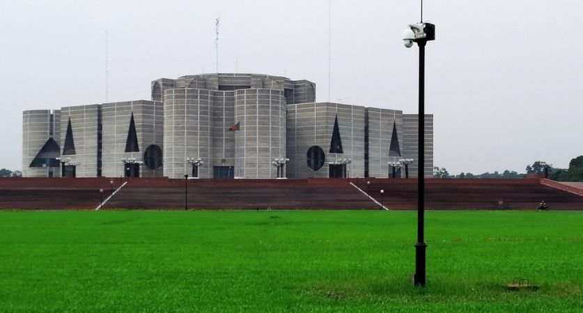
- National Parliament Complex
- Government offices
- Educational institutions
- Museums
- Corporate offices
Cantonment & Kafrul
The Cantonment area is home to Bangladesh Army headquarters and several military institutions, while Kafrul is a well-established residential neighborhood nearby.
Known For
- Military facilities
- Residential communities
- Parks
- Schools
- Hospitals
Major Areas in Dhaka South (DSCC)
Dhanmondi
Dhanmondi is one of Dhaka’s oldest planned residential neighborhoods and remains one of the city’s most desirable locations. It offers excellent healthcare, education, restaurants, shopping, and recreational facilities.
Major Areas
- Dhanmondi 1–32
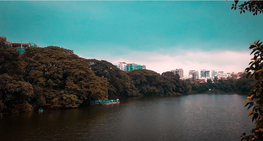
- Dhanmondi Lake
- Kalabagan
Known For
- Universities
- Hospitals
- Restaurants
- Shopping
- Cultural attractions
Shahbagh, Ramna & Green Road
Located in central Dhaka, these neighborhoods form the city’s educational, medical, and cultural core.
Major Areas
- Shahbagh
- Ramna
- Green Road
- Katabon
Known For
- University of Dhaka
- National Museum
- Suhrawardy Udyan
- Major hospitals
- Bookstores
Hatirjheel
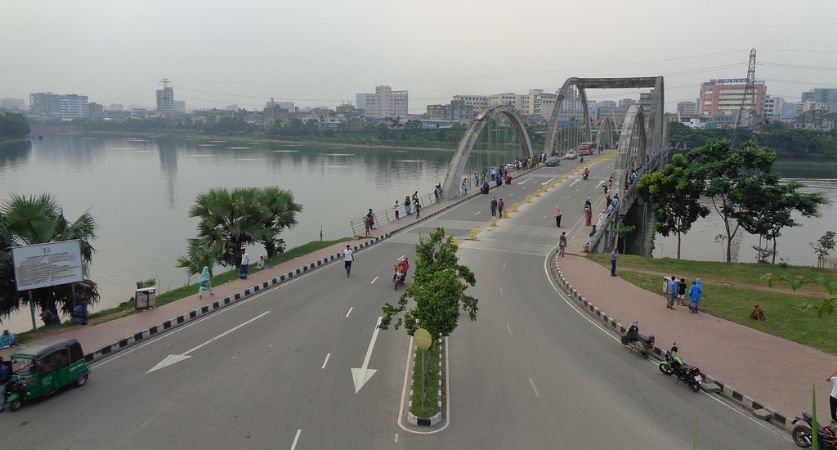
Hatirjheel is one of Dhaka’s most iconic urban development projects, transforming a former waterlogged area into a scenic lakefront with bridges, parks, cycling paths, and modern roads.
Known For
- Lakefront promenade
- Recreational spaces
- Photography
- Boat rides
- Road connectivity between eastern and central Dhaka
Hatirjheel also serves as an important transportation corridor linking several neighborhoods.
Rampura & Banasree
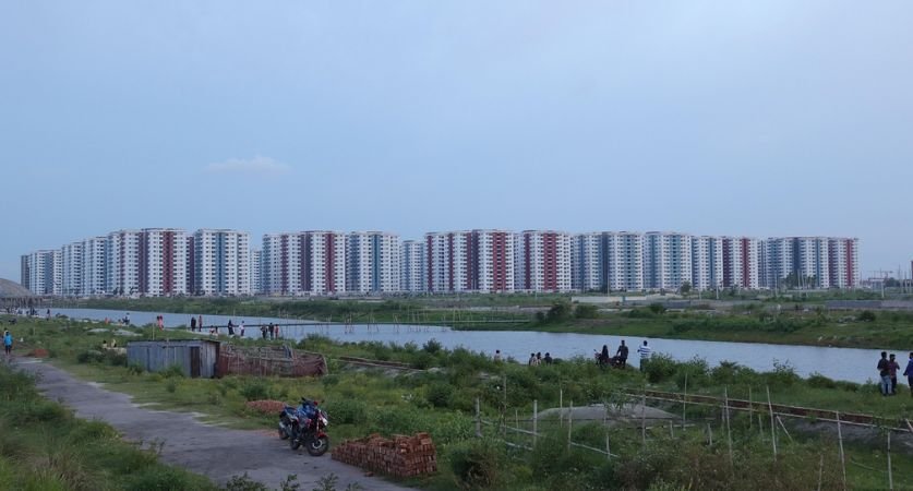
Located in eastern Dhaka, Rampura and Banasree have experienced rapid residential growth over the past two decades. Banasree is one of Bangladesh’s largest planned housing developments.
Major Areas
- Rampura
- Banasree Block A–T
Known For
- Planned housing
- Schools and colleges
- Shopping centers
- Family-friendly environment
Khilgaon, Basabo & Shahjahanpur
These neighboring communities are among Dhaka’s busiest residential areas, offering excellent connectivity to Motijheel, Gulistan, and central Dhaka.
Major Areas
- Khilgaon
- Taltola
- Basabo
- Shahjahanpur
Known For
- Residential apartments
- Railway connectivity
- Local markets
- Educational institutions
Motijheel & Dilkusha
Motijheel is Bangladesh’s primary financial district and the headquarters of many banks, insurance companies, and government agencies.
Major Areas
- Motijheel
- Dilkusha
- Fakirapool
Known For
- Bangladesh Bank
- Commercial offices
- Financial institutions
- Corporate headquarters
Kakrail, Segunbagicha & Shantinagar
These centrally located neighborhoods connect the business district with government offices and residential communities.
Known For
- Government ministries
- Hotels
- Corporate offices
- Religious institutions
Old Dhaka
Old Dhaka is the historic heart of the capital, dating back more than 400 years to the Mughal era. It is famous for its heritage buildings, traditional cuisine, wholesale markets, and vibrant cultural life.
Major Neighborhoods
- Lalbagh
- Armanitola
- Islampur
- Bangshal
- Kotwali
- Shankhari Bazar
- Chawkbazar
- Sutrapur
Known For
- Lalbagh Fort
- Ahsan Manzil
- Traditional food
- Wholesale markets
- Historic architecture
Jatrabari, Wari, Gendaria & Mugda
Located in southeastern Dhaka, these neighborhoods serve as important residential and transportation hubs connecting the capital with other regions of Bangladesh.
Major Areas
- Jatrabari
- Wari
- Gendaria
- Mugda
Known For
- Major highway connections
- Residential communities
- Local businesses
- Healthcare facilities
Why These Neighborhoods Matter
Together, these neighborhoods illustrate the diversity and scale of Greater Dhaka. From the diplomatic districts of Gulshan and Baridhara to the planned communities of Uttara, Bashundhara, and Banasree, the historic streets of Old Dhaka, and the commercial center of Motijheel, each area contributes to the city’s role as Bangladesh’s political, economic, educational, and cultural capital.
Combined with surrounding metropolitan areas such as Gazipur, Narayanganj, Savar, Keraniganj, and Tongi, these neighborhoods form one of the world’s fastest-growing and most densely populated metropolitan regions, making Greater Dhaka the undisputed urban heart of Bangladesh.
How Many People Live in Dhaka?
Dhaka is the largest and most populous city in Bangladesh and one of the fastest-growing megacities in the world. Over the past five decades, the city’s population has expanded at an extraordinary pace, transforming it from a regional capital into one of South Asia’s largest urban centers. Today, Dhaka serves as the country’s political, economic, financial, educational, and cultural hub, attracting millions of people from every district of Bangladesh.
The city’s rapid expansion has been fueled by industrialization, urban development, improved transportation, and continuous migration from rural communities. As a result, Greater Dhaka has become one of the world’s most densely populated metropolitan regions, with millions of residents living within a relatively compact urban area.
Whether you’re referring to the official city proper or the Greater Dhaka Metropolitan Area, the population continues to grow every year, making Dhaka one of the most dynamic and rapidly expanding cities in Asia.
Current Population
The official city of Dhaka, administered by Dhaka North City Corporation (DNCC) and Dhaka South City Corporation (DSCC), is estimated to have a population of approximately 10–11 million people.
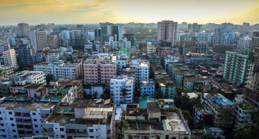
Although the city’s official land area covers only 306.4 square kilometers (118.3 square miles), it accommodates millions of residents living in apartments, residential neighborhoods, commercial districts, and mixed-use developments. This combination of limited land and a growing population has made Dhaka one of the most densely populated cities in the world.
The official city includes many of Dhaka’s most recognizable neighborhoods, including:
- Uttara
- Mirpur
- Gulshan
- Banani
- Baridhara
- Bashundhara Residential Area
- Mohammadpur
- Dhanmondi
- Motijheel
- Old Dhaka
- Rampura
- Banasree
- Khilgaon
- Shahjahanpur
These neighborhoods contain the majority of Bangladesh’s government institutions, corporate headquarters, financial centers, universities, hospitals, shopping districts, and diplomatic missions.
As the capital city, Dhaka functions as the center of nearly every major national activity. It is home to:
- The Parliament of Bangladesh
- Bangladesh Bank
- Supreme Court
- Government ministries
- Foreign embassies
- National universities
- Major hospitals
- Stock Exchange
- Corporate headquarters
- Technology companies
- International organizations
Because of these opportunities, thousands of people relocate to Dhaka every month in search of better employment, education, healthcare, and improved living standards.
Metropolitan Population
While the official city has around 10–11 million residents, the Greater Dhaka Metropolitan Area is significantly larger.
When neighboring urban centers such as:
- Gazipur
- Narayanganj
- Savar
- Keraniganj
- Tongi
- Purbachal New Town
are included, the metropolitan population reaches approximately 24.6–25 million people.
This larger metropolitan region functions as a single urban economy where municipal boundaries have become increasingly blurred. Every day, millions of commuters travel between surrounding cities and central Dhaka for employment, education, healthcare, business, and government services.
For example:
- Many people live in Gazipur but work in Gulshan or Motijheel.
- Residents of Narayanganj commute daily to Dhaka’s commercial districts.
- Thousands of students travel from Savar to universities in central Dhaka.
- Employees from Keraniganj cross the Buriganga River every day to reach offices and factories within the capital.
Improved highways, expressways, metro rail systems, railway connections, and bus networks have made commuting easier, allowing Greater Dhaka to function as one integrated metropolitan region.
Today, Dhaka ranks alongside metropolitan areas such as:
- Jakarta
- Manila
- Karachi
- Delhi
- Mumbai
as one of Asia’s largest urban agglomerations.
Population Growth
Dhaka’s population growth has been remarkable over the past several decades.
In the early years following Bangladesh’s independence in 1971, Dhaka had only a few million residents. Since then, rapid industrialization, economic development, and urban migration have caused the city’s population to multiply several times over.
Today, the metropolitan population exceeds 24 million, and projections suggest that Greater Dhaka will continue expanding over the coming decades.
This growth is driven by two primary factors:
- Natural population increase
- Continuous migration into the city
Unlike many developed cities with relatively stable populations, Dhaka continues to attract hundreds of thousands of new residents every year.
Annual Population Growth
The Greater Dhaka Metropolitan Area records an average annual population growth rate of approximately 2.8% to 3.0%.
Although this percentage may appear modest, it translates into hundreds of thousands of additional residents every year, placing immense pressure on housing, transportation, healthcare, education, utilities, and public infrastructure.
This consistent growth has resulted in:
- Expansion of residential neighborhoods
- Construction of high-rise apartment buildings
- Development of satellite towns
- Increased demand for roads and public transportation
- Expansion of metro rail and expressway projects
- Growth of commercial centers outside the traditional city core
Urban planners expect Dhaka’s metropolitan area to continue expanding toward Gazipur, Purbachal, Savar, Keraniganj, and Narayanganj over the coming decades.
Urban Migration
Urbanization has become one of Bangladesh’s defining demographic trends.
Every year, people from smaller towns and district headquarters relocate to Dhaka because the city offers significantly more opportunities than most other parts of the country.
People move to Dhaka to access:
- Better employment
- Higher salaries
- Higher education
- Specialized healthcare
- Modern infrastructure
- Business opportunities
- Improved public services
As Bangladesh’s economy continues to grow, Dhaka remains the country’s primary destination for internal migration.
Rural-to-Urban Migration
Perhaps the biggest contributor to Dhaka’s population growth is rural-to-urban migration.
Every year, hundreds of thousands of people leave villages and small towns to settle in the capital.
The main reasons include:
Employment Opportunities
The garment industry, manufacturing sector, construction industry, retail businesses, logistics companies, and service sector employ millions of workers in Dhaka.
Many migrants relocate because employment opportunities in rural districts remain limited.
Better Income
Workers can often earn significantly higher wages in Dhaka compared to agricultural or informal employment available in villages.
Education
Dhaka has the country’s largest concentration of:
- Universities
- Colleges
- Medical colleges
- Engineering institutions
- Research centers
Students from every region of Bangladesh come to Dhaka for higher education.
Healthcare
Many of Bangladesh’s largest hospitals and specialist medical centers are located in Dhaka.
Families frequently move to the city to obtain better medical treatment.
Climate Change
Bangladesh is highly vulnerable to:
- River erosion
- Flooding
- Cyclones
- Coastal salinity
- Climate displacement
Many families affected by environmental challenges migrate permanently to Dhaka in search of safer livelihoods.
Natural Population Increase
Migration is not the only reason Dhaka continues growing.
The city also experiences natural population increase, meaning births continue to outnumber deaths.
Although Bangladesh’s overall fertility rate has declined significantly over recent decades, Dhaka’s enormous population means that natural growth still contributes hundreds of thousands of additional residents over time.
Combined with continuous migration, this natural increase ensures that Dhaka remains one of the fastest-growing megacities in the world.
Why Is Dhaka So Densely Populated?
Dhaka is widely recognized as one of the most densely populated major cities on Earth. Within the official city boundaries, population density is estimated at 35,000–38,000 people per square kilometer, while some neighborhoods exceed 60,000–80,000 people per square kilometer, making them among the most crowded urban areas globally.
Unlike cities that expand horizontally over vast suburban regions, Dhaka’s growth has largely occurred within a relatively limited land area. As millions of people continue moving into the city each year, demand for housing, transportation, healthcare, schools, and employment has intensified, resulting in exceptionally high population density.
Several interconnected factors explain why Dhaka has become so densely populated.
Rural-to-Urban Migration
The most significant driver of Dhaka’s population density is the steady movement of people from rural Bangladesh to the capital.
Every year, hundreds of thousands of migrants arrive seeking:
- Better employment
- Improved education
- Higher incomes
- Better healthcare
- Greater economic security
Many rural households view Dhaka as the best place to improve their quality of life, even if living conditions are crowded.
Employment Opportunities
Dhaka is Bangladesh’s economic powerhouse, generating millions of jobs across numerous industries.
Major employment sectors include:
- Ready-made garment (RMG) manufacturing
- Banking and financial services
- Information technology
- Telecommunications
- Construction
- Retail and wholesale trade
- Real estate
- Government administration
- Logistics
- Healthcare
- Education
Because many of the country’s largest employers are based in Dhaka, workers from across Bangladesh relocate to the city every year.
Educational Opportunities
Dhaka is the nation’s educational capital.
The city hosts:
- University of Dhaka
- Bangladesh University of Engineering and Technology (BUET)
- Jagannath University
- Dhaka Medical College
- Numerous private universities
- Hundreds of colleges
- Technical institutes
- International schools
Students from every district move to Dhaka each year, increasing demand for housing and urban services.
Government Offices
Nearly every national government institution is headquartered in Dhaka.
These include:
- Parliament
- Prime Minister’s Office
- Supreme Court
- Bangladesh Bank
- National ministries
- Regulatory agencies
- Diplomatic missions
This concentration of government functions attracts civil servants, professionals, consultants, lawyers, and businesses that depend on government operations.
Healthcare Services
Dhaka offers Bangladesh’s most advanced healthcare system.
The city contains:
- Dhaka Medical College Hospital
- BSMMU
- Evercare Hospital
- Square Hospital
- United Hospital
- Specialized cardiac and cancer institutes
Patients from every region travel to Dhaka for specialized treatment, and many families relocate permanently to remain close to healthcare facilities.
Business and Investment Opportunities
Dhaka is Bangladesh’s commercial and financial capital.
The city hosts:
- Corporate headquarters
- Multinational companies
- Banks
- Insurance companies
- Stock market institutions
- Industrial headquarters
- Technology startups
- Import-export businesses
- Wholesale markets
Its vibrant economy continues attracting entrepreneurs, investors, and professionals from across the country.
Limited Land Availability
Unlike many global megacities that have expanded over vast suburban landscapes, Dhaka’s official city boundaries cover only 306.4 km².
With millions of residents competing for limited urban land, housing developments have expanded vertically through apartment buildings and high-rise complexes. This limited land area significantly contributes to the city’s exceptionally high population density.
Population Density at a Glance
| Population Metric | Approximate Value |
| Official City Population | 10–11 million |
| Metropolitan Population | 24.6–25 million |
| Official City Area | 306.4 km² |
| Metropolitan Area | 1,528 km² |
| Population Density | 35,000–38,000 people/km² |
| Annual Population Growth | 2.8–3.0% |
| Daily Commuters | Millions |
Dhaka’s remarkable population growth reflects its importance as Bangladesh’s political, economic, educational, and cultural center. While this rapid expansion has created challenges such as traffic congestion, housing shortages, environmental pollution, and infrastructure strain, it has also positioned Dhaka as one of South Asia’s most influential and dynamic metropolitan regions, with continued growth expected in the decades ahead.
How Big Is Dhaka Compared to Other Major Cities?
Dhaka is often compared with other global megacities because of its large population, rapid urban growth, and exceptional population density. Although Dhaka’s official city area is much smaller than many of the world’s largest cities, it accommodates an enormous number of residents within its limited boundaries.
This combination of a relatively compact land area and a massive population makes Dhaka one of the most densely populated major cities in the world. Compared with cities such as Delhi, Jakarta, Bangkok, London, and New York, Dhaka has less land but a comparable metropolitan population, highlighting the city’s unique urban landscape.
Comparison of Dhaka With Other Major Cities
| City | Official City Area | Metropolitan Population (Approx.) |
| Dhaka, Bangladesh | 306.4 km² | 24.6–25 million |
| Delhi, India | 1,484 km² | 34 million |
| Karachi, Pakistan | 3,780 km² | 20–21 million |
| Bangkok, Thailand | 1,569 km² | 17–18 million |
| Jakarta, Indonesia | 664 km² | 31–32 million |
| Manila, Philippines | 42.9 km² (City Proper) | 14–15 million |
| London, United Kingdom | 1,572 km² | 15 million |
| New York City, USA | 783.8 km² | 20 million |
Note: Population figures are approximate metropolitan estimates (2025–2026) and may vary slightly depending on the source and methodology.
Dhaka vs. Delhi
Delhi and Dhaka are both among South Asia’s largest megacities, but Delhi occupies a much larger land area.
- Delhi’s official area: Approximately 1,484 km²
- Dhaka’s official area: Approximately 306.4 km²
Although Delhi’s metropolitan population is larger, Dhaka accommodates nearly the same number of people within a much smaller space. As a result, Dhaka has a considerably higher population density, while Delhi benefits from more room for suburban expansion and planned urban development.
Dhaka vs. Karachi
Karachi is Pakistan’s largest city and principal economic center.
With an official area of approximately 3,780 km², Karachi is more than 12 times larger than Dhaka by land area. However, Karachi’s metropolitan population is slightly lower than Greater Dhaka’s.
This comparison highlights how Dhaka supports a larger urban population despite occupying only a fraction of Karachi’s land area.
Dhaka vs. Bangkok
Bangkok, Thailand’s capital, covers approximately 1,569 km², making it over five times larger than Dhaka.
Although Bangkok is geographically much larger, its metropolitan population remains significantly lower than Greater Dhaka’s. Bangkok also enjoys wider roads, more open spaces, and lower average population density than Dhaka.
Dhaka vs. Jakarta
Jakarta is one of Asia’s largest metropolitan regions and Indonesia’s economic powerhouse.
While Jakarta’s official city area is approximately 664 km², more than twice the size of Dhaka, its metropolitan population exceeds 30 million, making it one of the world’s largest urban agglomerations.
Both cities face similar urban challenges, including:
- Traffic congestion
- Flooding
- Housing demand
- Air pollution
- Infrastructure expansion
However, Jakarta has more available land for urban development than Dhaka.
Dhaka vs. Manila
The comparison between Dhaka and Manila is particularly interesting.
The City of Manila itself occupies only 42.9 km², making it much smaller than Dhaka. However, the Metro Manila region spans multiple cities and municipalities, creating a metropolitan population of around 14–15 million.
Like Dhaka, Metro Manila consists of numerous interconnected cities functioning as one metropolitan economy.
Dhaka vs. London
London covers approximately 1,572 km², making it more than five times larger than Dhaka.
Despite its much larger land area, London’s metropolitan population is considerably smaller than Greater Dhaka’s.
London’s lower density reflects:
- Extensive suburban development
- Strict urban planning
- Large public parks and green spaces
- Lower residential crowding
Dhaka, by contrast, accommodates more people within a far smaller urban footprint.
Dhaka vs. New York City
New York City has an official area of approximately 783.8 km², more than twice the size of Dhaka.
Although the New York metropolitan area is home to roughly 20 million people, Greater Dhaka has a larger population despite occupying a much smaller official city area.
New York benefits from:
- Larger transportation infrastructure
- More open public spaces
- Greater vertical development
- Extensive suburban expansion
Dhaka, however, supports a larger number of residents within a significantly more compact urban environment.
Which City Is More Densely Populated?
When comparing major cities worldwide, Dhaka consistently ranks among the most densely populated.
| City | Approximate Population Density |
| Dhaka | 35,000–38,000 people/km² |
| Manila (City Proper) | ~71,000 people/km² |
| Delhi | ~11,000 people/km² |
| Karachi | ~5,500 people/km² |
| Bangkok | ~3,600 people/km² |
| Jakarta | ~16,000 people/km² |
| London | ~5,700 people/km² |
| New York City | ~11,000 people/km² |
Among global megacities, Manila City Proper has the highest density, while Dhaka ranks among the world’s densest large metropolitan capitals. Its relatively small land area, combined with continuous migration, rapid urbanization, and strong economic opportunities, has created an urban environment where millions of people live and work within a remarkably compact space.
Overall, although Dhaka is smaller in land area than cities such as Delhi, Karachi, Bangkok, London, and New York, it rivals or surpasses many of them in metropolitan population. This unique combination of limited geographic size and extraordinary population makes Dhaka one of the world’s most significant and densely populated megacities.
How Fast Is Dhaka Expanding?
Dhaka is one of the fastest-growing megacities in the world, with its urban landscape continuously expanding beyond its traditional city boundaries. Over the past three decades, rapid population growth, economic development, industrialization, and infrastructure investments have transformed Dhaka into a vast metropolitan region stretching across neighboring districts such as Gazipur, Narayanganj, Savar, Keraniganj, and Purbachal.
Today, the city’s growth is no longer limited to its historic center. Instead, new residential communities, satellite towns, transportation projects, and commercial developments are reshaping Greater Dhaka and accommodating millions of new residents.
Urban Expansion
Dhaka’s urban footprint has expanded significantly since the 1980s. Areas that were once agricultural land or rural villages have evolved into densely populated residential and commercial neighborhoods.
Key drivers of urban expansion include:
- Rapid population growth
- Industrial development
- Increased foreign investment
- Expansion of transportation infrastructure
- Growth of the garment and service industries
- Rising demand for housing
The city continues expanding toward:
- Gazipur
- Savar
- Keraniganj
- Narayanganj
- Purbachal
- Tongi
These surrounding areas are becoming increasingly integrated into Greater Dhaka through highways, metro rail, and new housing developments.
New Residential Areas
To accommodate its growing population, Dhaka has witnessed the development of numerous planned residential communities.
Some of the most prominent include:
- Bashundhara Residential Area
- Banasree
- Aftabnagar
- Nikunja
- Baridhara DOHS
- Uttara Sectors 1–18
- Purbachal New Town
These developments provide modern housing, schools, hospitals, parks, shopping centers, and commercial spaces, helping to reduce pressure on older parts of the city.
Satellite Towns
Satellite towns play a crucial role in Dhaka’s future growth by distributing population and economic activity beyond the city center.
Major satellite towns include:
- Purbachal New Town
- Savar
- Gazipur
- Tongi
- Keraniganj
- Narayanganj
These areas are connected to Dhaka through major highways, expressways, and railway networks, allowing residents to commute while living outside the congested city core.
Dhaka Elevated Expressway
The Dhaka Elevated Expressway is one of Bangladesh’s largest transportation infrastructure projects.
The expressway:
- Connects the airport with southern Dhaka
- Reduces travel time
- Helps ease traffic congestion
- Improves connectivity between major business districts
- Supports future urban expansion
As additional sections become operational, the expressway is expected to significantly improve mobility across Greater Dhaka.
Dhaka Metro Rail
The introduction of the Dhaka Metro Rail (MRT Line-6) marks a historic milestone in the city’s transportation system.
The Metro Rail:
- Connects Uttara to Motijheel
- Reduces commuting time
- Carries thousands of passengers daily
- Reduces dependence on road transport
- Supports sustainable urban development
Future MRT lines are planned to connect additional parts of Greater Dhaka, creating a comprehensive rapid transit network.
Purbachal New Town
Purbachal New Town is Bangladesh’s largest planned satellite city.
Developed by RAJUK, it is designed to accommodate hundreds of thousands of residents through:
- Modern residential sectors
- Commercial districts
- Educational institutions
- Healthcare facilities
- Parks and green spaces
- Government offices
Purbachal is expected to become one of Dhaka’s most important urban centers over the coming decades.
Uttara
Uttara continues expanding northward through new residential sectors, commercial developments, educational institutions, and Metro Rail connectivity.
Recent developments include:
- Sector 18
- Diabari
- Airport expansion
- New business districts
- High-rise residential projects
The area is becoming one of Dhaka’s largest mixed-use urban centers.
Savar
Located northwest of Dhaka, Savar has emerged as one of the city’s fastest-growing suburban areas.
Its growth is supported by:
- Export Processing Zone (EPZ)
- Universities
- Industrial parks
- Residential housing projects
- Improved highway connections
Savar is expected to play a major role in accommodating Greater Dhaka’s future population.
Future Growth
Urban planners expect Greater Dhaka to continue expanding over the coming decades. Major projects such as new Metro Rail lines, Bus Rapid Transit (BRT), expressways, satellite cities, and smart urban developments will reshape the metropolitan area.
Future priorities include:
- Expansion toward Gazipur and Purbachal
- Smart city initiatives
- Sustainable transportation
- Affordable housing
- Digital infrastructure
- Improved public services
With continued economic growth and infrastructure investment, Dhaka is expected to remain one of the world’s fastest-growing metropolitan regions.
Administrative Structure of Dhaka
Dhaka’s administrative structure is organized across multiple levels of government, each responsible for different aspects of governance, urban planning, and public administration. Understanding these divisions helps explain why the terms Dhaka City, Dhaka District, Dhaka Division, and Greater Dhaka are often used differently.
Dhaka North City Corporation (DNCC)
The Dhaka North City Corporation (DNCC) administers the northern portion of the capital.
It is responsible for:
- Road maintenance
- Waste management
- Drainage
- Public health
- Parks
- Markets
- Urban planning
- Civic services
Major neighborhoods include:
- Uttara
- Mirpur
- Gulshan
- Banani
- Baridhara
- Bashundhara
- Badda
- Khilkhet
- Mohammadpur
- Agargaon
DNCC contains approximately 54 wards and covers around 197.4 km².
Dhaka South City Corporation (DSCC)
The Dhaka South City Corporation (DSCC) governs the historic and central parts of Dhaka.
It oversees:
- Heritage conservation
- Municipal services
- Road maintenance
- Public health
- Local administration
- Urban infrastructure
Major neighborhoods include:
- Dhanmondi
- Motijheel
- Old Dhaka
- Ramna
- Shahbagh
- Rampura
- Banasree
- Khilgaon
- Basabo
- Jatrabari
DSCC consists of approximately 75 wards covering around 109 km².
Dhaka District
The Dhaka District is a larger administrative unit that includes both city corporations as well as surrounding upazilas (sub-districts).
Besides the city, Dhaka District includes areas such as:
- Keraniganj
- Dhamrai
- Nawabganj
- Dohar
- Savar
The district is administered by the Deputy Commissioner (DC) and oversees broader administrative functions beyond municipal governance.
Dhaka Division
The Dhaka Division is Bangladesh’s largest administrative division and encompasses multiple districts, including Dhaka District.
The division includes districts such as:
- Dhaka
- Gazipur
- Narayanganj
- Manikganj
- Munshiganj
- Tangail
- Kishoreganj
- Faridpur
- Rajbari
- Gopalganj
- Madaripur
- Shariatpur
Dhaka Division functions as a regional administrative unit under the Government of Bangladesh and is significantly larger than Dhaka city or district.
Understanding the Difference
| Administrative Level | Covers | Primary Responsibility |
| Dhaka North City Corporation (DNCC) | Northern Dhaka | Municipal services and local governance |
| Dhaka South City Corporation (DSCC) | Southern Dhaka | Municipal services and local governance |
| Dhaka District | City + surrounding upazilas | District-level administration |
| Dhaka Division | Multiple districts | Regional administration and governance |
These administrative layers work together to manage one of the world’s largest and most complex urban regions.
Economy of Dhaka
Dhaka’s size cannot be measured solely by its land area or population. Its true significance lies in its role as Bangladesh’s economic powerhouse, generating a substantial share of the country’s economic output and serving as the center of commerce, finance, government, education, and innovation.
As the national capital, Dhaka contributes a significant portion of Bangladesh’s GDP and acts as the headquarters for most of the country’s largest businesses, banks, multinational corporations, and government agencies.
GDP Contribution
Dhaka is estimated to contribute more than one-third of Bangladesh’s Gross Domestic Product (GDP), making it the country’s most productive economic region.
Major contributors include:
- Manufacturing
- Financial services
- Information technology
- Construction
- Retail
- Telecommunications
- Government services
The city’s economy continues expanding as Bangladesh experiences sustained economic growth.
Business Hub
Dhaka serves as the headquarters for thousands of national and international companies.
Key business districts include:
- Motijheel
- Gulshan
- Banani
- Tejgaon
- Bashundhara
These areas host corporate offices, business centers, hotels, and commercial complexes that drive Bangladesh’s economy.
Banking and Finance
Nearly every major financial institution in Bangladesh operates from Dhaka.
The city is home to:
- Bangladesh Bank
- Dhaka Stock Exchange
- Commercial banks
- Insurance companies
- Investment firms
- Financial regulators
As the country’s financial center, Dhaka manages the majority of Bangladesh’s banking and investment activities.
Garment Industry
Bangladesh’s globally recognized Ready-Made Garment (RMG) industry is centered around Greater Dhaka.
Industrial areas in:
- Gazipur
- Savar
- Narayanganj
- Tongi
support thousands of garment factories employing millions of workers and generating billions of dollars in export revenue each year.
Technology and Innovation
Dhaka has become Bangladesh’s leading technology hub.
The city hosts:
- Software companies
- IT parks
- Startup incubators
- E-commerce businesses
- Fintech companies
- Digital service providers
Government initiatives supporting the Digital Bangladesh vision continue to accelerate technological innovation.
Government and Public Administration
As the capital city, Dhaka houses:
- Parliament
- Prime Minister’s Office
- Government ministries
- Supreme Court
- Foreign embassies
- Regulatory agencies
These institutions generate substantial employment and attract businesses that support government operations.
Education
Dhaka is also Bangladesh’s educational capital.
The city contains:
- University of Dhaka
- BUET
- Jagannath University
- Dhaka Medical College
- Numerous private universities
- Research institutes
- Technical colleges
The concentration of educational institutions attracts students, researchers, and professionals from across the country.
Transportation Across Dhaka
Efficient transportation is essential for supporting a metropolitan region of more than 24 million people. Every day, millions of commuters travel across Dhaka for work, education, healthcare, shopping, and business.
To support this growing demand, Dhaka continues investing in modern transportation infrastructure.
Metro Rail
The Dhaka Metro Rail (MRT Line-6) is Bangladesh’s first mass rapid transit system.
Benefits include:
- Faster commuting
- Reduced traffic congestion
- Lower travel times
- Improved air quality
- Sustainable transportation
Future MRT lines will connect additional neighborhoods throughout Greater Dhaka.
Bus Rapid Transit (BRT)
The Dhaka Bus Rapid Transit (BRT) project is designed to provide dedicated bus corridors connecting Gazipur with the airport and other parts of the metropolitan area.
The system aims to:
- Reduce congestion
- Improve public transportation
- Lower travel costs
- Increase commuter capacity
Rickshaws
Dhaka is often called the Rickshaw Capital of the World, with hundreds of thousands of cycle rickshaws operating across the city.
Rickshaws remain an essential form of transportation for:
- Short-distance travel
- Neighborhood commuting
- Last-mile connectivity
Roads and Highways
Dhaka’s extensive road network includes:
- Airport Road
- Pragati Sarani
- Mirpur Road
- VIP Road
- Dhaka Elevated Expressway
- Dhaka Bypass
- Multiple national highways
These roads connect the capital with every region of Bangladesh.
Hazrat Shahjalal International Airport
Located in Uttara, Hazrat Shahjalal International Airport is Bangladesh’s busiest international airport.
It connects Dhaka with:
- Asia
- Europe
- Middle East
- North America (via connecting hubs)
The airport supports tourism, business, exports, and international trade.
Railways
Bangladesh Railway operates major stations in Dhaka, including:
- Kamalapur Railway Station
- Airport Railway Station
Rail services connect Dhaka with major cities throughout Bangladesh.
River Transport
Situated along the Buriganga River, Dhaka also benefits from extensive inland waterways.
Major river terminals, particularly Sadarghat Launch Terminal, connect the capital with southern and coastal districts, supporting both passenger travel and cargo transportation.
How Transportation Supports a Megacity
An integrated transportation network is vital to keeping a city of Dhaka’s size functioning efficiently. Metro Rail, BRT, roads, railways, airports, and river transport work together to move millions of people and large volumes of goods every day. As new infrastructure projects are completed, Dhaka is expected to become more connected, more accessible, and better equipped to support its growing population and expanding economy, reinforcing its status as one of South Asia’s leading megacities.